Surf Checks and Cams | Surf Forecasts | WAMs | Weather | Search | Home

UK weather for surfers

The graphics provide a direct link to the image or index. The text links to the site's home page. All the images here are small low resolution (bandwidth saving) thumbnails of the real thing. The full pictures usually cover a full basin, continent or globe rather than just the UK as shown.

Winds.

Recommended Site!
XC Weather

XC Weather for a current winds with a hand GUI. Also available in text from NOAA/NWS Current Weather conditions at UK airports page.

AVN Wind Chart

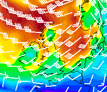
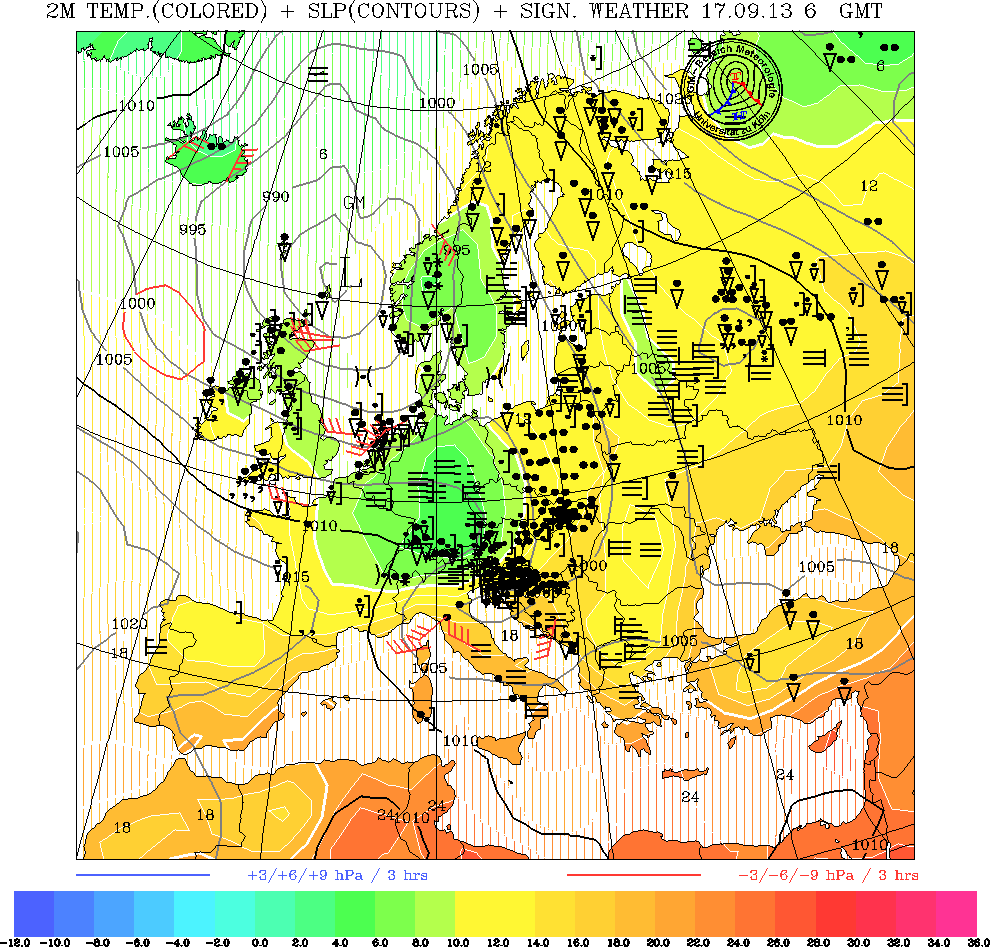
NOAA AVN wind forecast chart is very easy to read. The wind direction with wind barbs. The barbs point into the wind and each 'feather' is 10 knots, (5m/s) half a feather is 5 knots. Brought to you by Top Karten

t+00h | t+12h | t+18h | t+24h | t+30h | t+36h | t+42h | t+48h | t+54h | t+60h | t+66h | t+72h

Weather Forecasts

BBC Weather Page  

The Latest UK Weather page at the  and have just about all you need.

UK Met Office.

The Shipping Forecast and Inshore Waters Forecast from the UK Met Office. They also provide a Map of sea areas.

You may also want the latest Synoptic charts.

Synoptic Charts. 

The UK Met Office now puts some charts on its web page. Showing clouds from infrared satellite images combined with the surface pressure chart.

Other Met office charts are also available via the Excellent Top Karten site.

Forecast Chart

The European Center for Medium Range Weather Forecasting do forecast charts for Western Europe for 3 to 6 days ahead

Chart

The most recent synoptic chart of Europe. From Cologne University's collection of Latest Surface Maps for Europe. These are updated every 6 hours. 

Satellite Imagery. 

Daily satellite photos are available from the UK Met Office. Plus: 

Latest pass (~300k) by a GOES polar orbiting satellite. From Dundee Satellite Station.
You now have to register, (free, via the homepage) to receive these images.


Temperature Chart

"Come on in, the waters lovely." Check the Sea Surface Temperature chart (35k) from Top Karten or the Met Office SST chart.

Latest Global Ocean Surface Tem perature Map from FNMOC. (115k, but very pretty.) 

See also the other surf forecast pages around the ocean and 
the European Weather Links page for weather forecasts.

Other Links.


Home

Surf Checks and Cams | Surf Forecasts | WAMs | Weather | Search